Translate
Overview
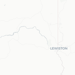
Weston is a small agricultural community of roughly 650 residents situated in Umatilla County in northeastern Oregon, at the base of the Blue Mountains at an elevation of approximately 1,800 feet. The town sits along the historic Oregon Trail corridor and has deep roots in wheat and grain farming that continue to define the local economy and landscape today.
The surrounding countryside offers rolling wheat fields, open skies, and quick access to higher-elevation forest land. Weston is not a tourist destination in the conventional sense — it has no major attractions or resort infrastructure — but it appeals to travelers seeking an authentic look at small-town Oregon, rural Americana, and the natural scenery of the Blue Mountains foothills.
Most visitors pass through Weston as part of a broader northeastern Oregon trip that might include Pendleton, the Umatilla National Forest, or the Wallowa Mountains further east. For those who slow down, the town offers a genuine, unhurried pace and access to some remarkably quiet backcountry.
Before You Go
Visas and Entry
Weston is a domestic US destination. International travelers entering the United States should check TravelerPulse's Visas section and consult the official US Customs and Border Protection website (cbp.gov) or the US Embassy or consulate in their home country for current entry requirements. Rules vary significantly by nationality.
Trip Planning Context
Weston works best as one stop within a broader northeastern Oregon or Oregon-Washington border region itinerary. Combining it with Pendleton (including the Pendleton Round-Up if timing aligns), Milton-Freewater, the Walla Walla Valley wine region in Washington, or a longer drive toward the Wallowa Mountains gives the visit more substance. Traveling with a flexible schedule is advisable given the limited services in the area.
Getting There
Weston is located on Oregon Route 204, approximately 20 miles southeast of Pendleton via OR-11 and OR-204. Driving is the only practical way to reach the town, as there is no commercial air service, intercity bus service, or passenger rail serving Weston directly.
Nearest Airports
The closest commercial airport is Eastern Oregon Regional Airport (PDT) in Pendleton, which offers limited regional connections. Spokane International Airport (GEG) in Washington, roughly two hours north, provides significantly more flight options and may be the more practical choice for travelers arriving from distant cities.
By Car
From Pendleton, take OR-11 south toward Milton-Freewater, then head east on OR-204 toward Weston. The drive is straightforward and scenic. From the west via I-84, take the Pendleton exits and follow OR-11 south. Road conditions on OR-204 can be affected by snow and ice in winter months — verify conditions before travel during that season.
Getting Around
A personal vehicle is essential in Weston. There is no local public transportation, and the town itself is small enough to walk in its entirety in under twenty minutes. If you plan to explore surrounding areas — including Umatilla National Forest roads or the drive up toward Tollgate — a vehicle with reasonable ground clearance is advisable, particularly on unpaved forest roads.
Gas and basic services are available in Weston, but travelers heading into more remote forest areas should fill up and carry water and supplies before departing, as services become sparse quickly once you leave the highway.
Where to Stay
Weston does not have established hotel or motel accommodations as of this writing — verify locally for any bed-and-breakfast or short-term rental options that may exist. Pendleton, roughly 20 miles away, is the practical base for overnight stays in this part of northeastern Oregon and offers motels, chain hotels, and some locally operated lodgings in a range of price points.
Seasonal camping is available in Umatilla National Forest, including sites accessible via OR-204 east of Weston. Contact the Walla Walla Ranger District of Umatilla National Forest for current campground status, reservation requirements, and fees.
Things to See & Do
Umatilla National Forest Access
OR-204 east of Weston climbs into the Blue Mountains and provides access to the Umatilla National Forest. This stretch of highway passes through mixed conifer forest and reaches the small community of Tollgate, where there are recreational opportunities including hiking, snowmobiling (in winter), and seasonal camping. Verify campground availability and road conditions with the Umatilla National Forest's Walla Walla Ranger District before visiting.
Historic Townsite
Weston's downtown retains some historic architecture from its late 19th- and early 20th-century development period, reflecting the town's origins as a farming supply center. Walking the few blocks of the main commercial area gives a sense of the town's agricultural history.
Scenic Drives
The drive along OR-204 between Weston and the Blue Mountains is itself a worthwhile experience, especially in autumn when foliage changes, or in early summer when the wheat fields are vivid green. The route connecting Weston, Milton-Freewater, and the broader Walla Walla Valley offers a quiet alternative to the interstate corridor.
Wildlife Observation
The agricultural and forest-edge landscape around Weston supports deer, raptors, and migratory birds. Casual wildlife watching along rural roads requires no special equipment or planning.
Food & Drink
Dining options in Weston are limited by the town's size. There are no chain restaurants, and the availability of local establishments should be verified before relying on them, as small-town businesses in rural Oregon can change hours or close without significant notice.
Milton-Freewater (approximately 10 miles northwest) and Pendleton (approximately 20 miles northwest) offer significantly more dining variety, including locally owned restaurants, diners, and some craft beverage establishments tied to the broader Walla Walla wine region. Travelers should plan meals accordingly and consider Pendleton as a base if dining options matter.
For self-catering, bring supplies from Pendleton or a larger town if you plan to spend time in the Weston area or heading into forest land.
Practical Information
Connectivity and Services
Cell service can be limited or unreliable in and around Weston, particularly once you head into the Blue Mountains. Download offline maps before your trip. Wi-Fi availability at local businesses should not be assumed.
Weather
Northeastern Oregon experiences four distinct seasons. Summers are warm and dry; winters can bring significant snow, particularly at elevation. OR-204 into the Blue Mountains can be snow-covered or icy from late fall through early spring — check Oregon Department of Transportation's TripCheck service (tripcheck.com) for current road conditions.
Supplies
Stock up on fuel, food, water, and any needed medications in Pendleton before heading to Weston or the surrounding forest, especially if you plan outdoor activities. The nearest hospital and emergency medical services are in Pendleton.
Emergency Services
For emergencies, dial 911. Verify the location of the nearest hospital and urgent care in Pendleton before your trip.