Translate


Overview
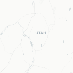
Salem is a small city of roughly 7,500 residents situated in Utah County in the Wasatch Front region of northern Utah, positioned between Spanish Fork to the north and Payson to the south. The city sits at the foot of the Wasatch Range and overlooks a portion of the valley floor that was historically used for farming and ranching.
The community retains a distinctly residential and rural character compared with its larger neighbors. Salem is not a conventional tourist destination, but travelers passing through Utah County, or those seeking a quieter base away from the bustle of Provo or Orem, may find it a practical stop. The surrounding landscape — mountains to the east, open valley to the west — offers scenic context typical of the Wasatch Front.
Getting There
Nearest Airport
Provo Municipal Airport (PVU) is the closest commercial airport, located roughly 15 miles north of Salem. Salt Lake City International Airport (SLC), approximately 55 miles north, offers significantly more flight options and is the primary gateway for most travelers to this region.
By Road
Salem is accessible via US-6 and Utah State Route 198, which connects it with Spanish Fork and Payson. Interstate 15 runs parallel to the west, with exits serving the broader Utah County corridor. Driving from Salt Lake City typically takes 45–60 minutes depending on traffic.
By Public Transit
Utah Transit Authority (UTA) operates bus routes in Utah County. Service to or through Salem may be limited; verify current routes and schedules at rideuta.com before traveling. A personal vehicle is the most practical option for visiting Salem.
Getting Around
A personal vehicle is essentially required to get around Salem and explore the surrounding area. The city is spread across a low-density residential grid, and there are no meaningful local transit options within the city itself.
Ride-hailing services such as Uber and Lyft are available in Utah County and may serve Salem, though wait times could be longer than in urban centers. Cycling is feasible on surface streets given relatively low traffic volumes, but there are no dedicated regional cycling trails within Salem itself.
Where to Stay
Salem does not have a significant hotel or lodging inventory of its own. Travelers will find more options in neighboring Spanish Fork, Payson, or further north in Provo and Orem, which have a full range of chain hotels, motels, and some independent properties.
Short-term rental platforms may list homes in Salem itself, which could suit travelers who prefer a residential setting. Always verify listings and cancellation policies directly with the platform before booking.
Things to See & Do
Salem's own attractions are limited, but the surrounding area offers meaningful outdoor recreation. The foothills of the Wasatch Range are accessible within a short drive, with hiking and trail access points found in nearby Spanish Fork Canyon and the Payson area.
Nearby Natural Areas
- Spanish Fork Canyon (US-6 corridor): A scenic canyon route leading eastward toward Price and carbon country, suitable for drives and access to dispersed recreation areas.
- Payson Lakes Recreation Area: Located in the Uinta-Wasatch-Cache National Forest south of Payson, offering camping, fishing, and hiking. Verify access, fees, and seasonal conditions with the U.S. Forest Service before visiting.
- Utah Lake: A large freshwater lake a short drive west, offering boating, fishing, and birdwatching through Utah Lake State Park.
Salem Pond, a small local fishing pond within the city, is a low-key spot popular with families and local anglers. Verify access and fishing regulations with the Utah Division of Wildlife Resources.
Food & Drink
Salem has a small number of local eateries and convenience options, but dining choices are quite limited within city limits. Spanish Fork, just a few miles north, has a broader selection of restaurants ranging from national fast-food chains to local diners and family restaurants.
Utah is a state with specific liquor laws: alcohol is sold through state-run liquor stores (DABC stores) and licensed restaurants. Beer with higher alcohol content and spirits are not available in standard grocery stores. Travelers who drink alcohol should familiarize themselves with Utah's regulations and plan accordingly. Verify current DABC store locations and hours at alcohol.utah.gov.
Practical Information
Visas
Salem is in the United States. For visa and entry requirements, check TravelerPulse's Visas section and the official U.S. Customs and Border Protection website (cbp.gov) for current guidance.
Emergency Services
Dial 911 for police, fire, or medical emergencies anywhere in the United States.
Climate
Salem experiences a semi-arid continental climate. Summers are warm and dry (June–August), with temperatures frequently in the 80s–90s°F (high 20s–low 30s°C). Winters are cold with occasional snowfall, though the valley floor typically sees less snow accumulation than the nearby mountains. Spring and autumn are mild and generally pleasant.
Cell Coverage and Internet
Major U.S. carriers (Verizon, AT&T, T-Mobile) provide coverage throughout the Utah County valley. Coverage may degrade in canyon areas east of the city.
Tipping
Standard U.S. tipping practices apply: 15–20% at sit-down restaurants, $1–2 per drink at bars, and discretionary amounts for other services.
Safety
Salem is a quiet, low-crime residential community. Standard common-sense precautions apply: secure your vehicle, do not leave valuables visible, and be aware of your surroundings, particularly when hiking or driving in canyon areas.
If engaging in outdoor activities in the Wasatch Range, inform someone of your plans, carry water (dehydration is a real risk at altitude in Utah's dry climate), and check weather conditions before heading into canyons or higher elevations. Flash flooding can occur in canyon areas during monsoon-season storms, typically July–September.
Local Culture & Etiquette
Salem is part of Utah County, which has a high concentration of members of The Church of Jesus Christ of Latter-day Saints (LDS). This shapes local culture in practical ways: many businesses may be closed or have reduced hours on Sundays, alcohol is less prevalent than in other parts of the United States, and community life often centers on family and faith-based activities.
Visitors should approach local customs respectfully. The community is generally welcoming to outsiders. Local events, when they occur, tend to be family-oriented and community-focused.