Overview
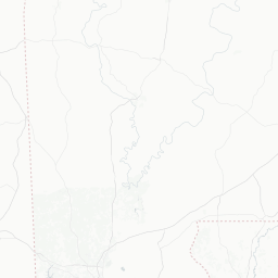
Oriole Beach is a small unincorporated community in Santa Rosa County, Florida, situated along the northern shore of Escambia Bay. With a population of roughly 1,400 residents, it functions as a quiet residential enclave rather than a conventional tourist destination, offering a glimpse into the relaxed pace of Florida's Panhandle bayshore life.
The community sits just east of Pensacola, making it an easy detour or overnight stop for travelers already exploring the greater Pensacola area. The bay views, modest marina activity, and access to surrounding natural areas give it a low-key appeal for those seeking solitude over spectacle.
Visitors to Oriole Beach are typically drawn by fishing, boating, and the desire to experience a genuinely local corner of the Florida Panhandle — far removed from the bustle of beach resort strips.
Before You Go
Visas and Entry
Oriole Beach is in the United States. For visa and entry requirements, check TravelerPulse's Visas section and the official U.S. Customs and Border Protection website at cbp.gov.
What to Pack
- Lightweight, breathable clothing is suitable for most of the year; bring a layer for cooler evenings in winter months (December–February).
- Sun protection — sunscreen, hat, and sunglasses — is essential year-round in the Florida Panhandle.
- Insect repellent is advisable, particularly near the bay and wooded edges in warmer months.
- If you plan to fish or boat, confirm any required Florida fishing licenses in advance through the Florida Fish and Wildlife Conservation Commission (myfwc.com).
Health
No vaccinations are specifically required for travel to this area. Tap water is municipally treated; verify locally if staying in rural outskirts. Summer heat and humidity can be significant — stay hydrated.
Getting There
By Air
The nearest commercial airport is Pensacola International Airport (PNS), located approximately 10–15 miles west of Oriole Beach. It receives flights from several major U.S. hubs. Verify current routes and schedules directly with airlines or the airport.
By Car
Oriole Beach is most practically reached by car. It lies near U.S. Highway 98, which runs along the northern edge of Escambia Bay and connects the community to Pensacola to the west and Gulf Breeze and Navarre to the east. A personal vehicle or rental car is strongly recommended, as local public transit options are very limited.
By Bus
Escambia County Area Transit (ECAT) serves the broader Pensacola metropolitan area. Coverage in small communities like Oriole Beach is limited — verify current routes and stops at ecat.org before relying on public transit.
Getting Around
A personal vehicle is essentially required for getting around Oriole Beach and accessing nearby attractions. The community itself is small enough to walk through in a short time, but reaching restaurants, shops, or recreational sites outside the immediate area requires driving.
Rideshare services such as Uber and Lyft operate in the Pensacola metro area, though availability in smaller outlying communities like Oriole Beach may be inconsistent — verify coverage before relying on them, especially at off-peak hours.
Boating is a meaningful mode of access for those with watercraft, given the community's bayfront position on Escambia Bay.
Things to See & Do
Fishing and Boating
Escambia Bay access is the primary draw for active visitors. The bay supports fishing for species such as redfish, speckled trout, and flounder, among others. Verify current regulations and licensing requirements at myfwc.com before fishing.
Nature and Birdwatching
The bay shoreline and surrounding wetlands attract shore and wading birds, making the area of modest interest to birdwatchers. The broader Santa Rosa County corridor is known for migratory bird activity in spring and fall.
Day Trips from Oriole Beach
Oriole Beach's greatest value for visitors may be its position as a quiet base for exploring the surrounding region. Gulf Islands National Seashore, the city of Pensacola, Gulf Breeze Zoo, and Navarre Beach are all within reasonable driving distance.
- Gulf Islands National Seashore — protected barrier island beaches and historic forts
- Pensacola — museums, historic district, and waterfront dining
- Navarre Beach — uncrowded Gulf-front beach roughly 20 miles east
Food & Drink
Oriole Beach itself has very limited dining options given its small population. Visitors should expect to drive to nearby Gulf Breeze or into Pensacola for a meaningful selection of restaurants, cafes, and bars.
The Gulf Breeze area, just a short drive west, has a modest but practical range of casual dining — seafood-focused restaurants are common throughout the Pensacola Bay area. Confirm operating hours locally, as smaller establishments in the Panhandle can keep variable schedules.
Grocery shopping is similarly best handled in Gulf Breeze or Pensacola before arriving, particularly if staying in a self-catering accommodation.
Practical Information
Time Zone
Oriole Beach observes Central Time (CT), which is UTC−6 in standard time and UTC−5 during daylight saving time. Note that Pensacola and Santa Rosa County are in the Central Time zone, while some parts of the Florida Panhandle further east observe Eastern Time — confirm locally if scheduling matters.
Connectivity
Cellular coverage from major U.S. carriers is generally available. Wi-Fi availability will depend on your accommodation.
Emergency Services
- For emergencies in the United States, dial 911.
- Santa Rosa County Sheriff's Office serves the unincorporated community area; verify non-emergency contact numbers locally.
Currency and Payments
The US Dollar is the only currency used. Credit and debit cards are widely accepted throughout the region. ATMs are available in nearby Gulf Breeze and Pensacola.
Safety
Oriole Beach is a small, quiet residential community with no particular safety concerns beyond standard travel awareness. As with any unfamiliar area, secure your vehicle and belongings, especially at waterfront access points.
Hurricane season runs from June through November. The Florida Panhandle is within the Gulf Coast hurricane risk zone — monitor National Hurricane Center forecasts (nhc.noaa.gov) during this period if traveling. Local evacuation routes and shelter information are managed by Santa Rosa County Emergency Management; verify current guidance locally.
Water safety is worth observing for anyone boating or swimming in Escambia Bay — conditions and currents can vary. Check any posted advisories regarding water quality before swimming in bay waters.