Translate
Overview
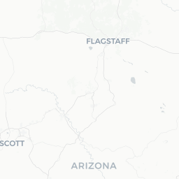
Young is a small, isolated community of roughly 600–700 residents sitting at approximately 5,000 feet elevation in the Sierra Ancha region of Gila County, Arizona. It occupies Pleasant Valley, a wide mountain meadow hemmed in by forested ridgelines, and serves as the informal hub for the surrounding ranching and recreation landscape.
The town is most historically notable as the setting of the Pleasant Valley War (also called the Tewksbury-Graham Feud), a prolonged and deadly range conflict of the 1880s that became one of the bloodiest family feuds in American frontier history. That history is part of the local identity and occasionally surfaces in interpretive signs, local conversation, and regional literature.
For visitors today, Young functions primarily as a base for accessing the Tonto National Forest, which surrounds it on multiple sides. The area attracts hunters, anglers, hikers, and people simply seeking genuine remoteness. Services are limited — this is not a tourist-resort destination — so arriving well-prepared is essential.
Before You Go
Visas and Entry
Young is within the continental United States. Entry requirements depend on your nationality. Check TravelerPulse's Visas section and the U.S. Customs and Border Protection website for current requirements before travel.
Cell Service and Connectivity
Cell phone coverage in and around Young is extremely limited or nonexistent for most carriers. Do not rely on GPS navigation or mobile data once you leave the main highways. Download offline maps (such as Gaia GPS or Google Maps offline) before departure and carry printed directions.
Fuel and Supplies
Fuel up before heading into Young. A small general store operates in town (verify current hours and availability locally), but selection is limited. Stock up on food, water, medications, and any specialty gear in Globe, Show Low, or Payson before making the drive.
Road Conditions
The primary routes into Young — particularly Arizona State Route 288 from the south and the road from the north via SR-188 — pass through mountainous terrain with steep grades and tight curves. Parts of these routes are unpaved or subject to seasonal closures. Check conditions with the Arizona Department of Transportation (ADOT) or the Tonto National Forest before traveling, especially after rain or winter weather.
Getting There
Young has no airport, bus service, or rail connection. A personal vehicle or rental car is the only practical means of arrival.
By Car from Major Points
- From Phoenix: Approximately 2.5–3 hours via US-60 East to Globe, then north on SR-288 through the Salt River Canyon rim country. This is the most commonly used southern approach.
- From Show Low / Pinetop: Roughly 1.5–2 hours via SR-260 to SR-288 heading south. Road conditions on this stretch can be rough; verify locally.
- From Payson: Approximately 1.5–2 hours via SR-87 south then east on SR-188 and connecting forest roads. Portions of this route may require a high-clearance vehicle — verify before departure.
All approaches involve winding mountain roads. Allow extra time, especially if you are unfamiliar with the terrain or towing a trailer.
Getting Around
There is no public transportation within Young or the surrounding area. A vehicle is essential for all movement, including reaching trailheads, fishing access points, and campgrounds scattered throughout the Tonto National Forest.
A high-clearance vehicle — and sometimes four-wheel drive — is advisable for accessing many forest roads and recreation sites beyond the immediate town center. Road conditions change with weather, so inquire locally or check with the Tonto National Forest Globe Ranger District before heading out on unpaved routes.
Where to Stay
Accommodation in Young is modest and limited. A small number of locally operated cabins and a motel-style property have historically been available in and around town; verify current availability and book in advance, as options are few and can fill during hunting seasons (fall) and holiday weekends.
Dispersed camping in the Tonto National Forest is a popular option for many visitors. There are established campgrounds within reasonable distance; check with the Globe Ranger District of the Tonto National Forest for current campsite availability, permit requirements, and fire restrictions, which change seasonally.
For visitors who prefer more amenity-rich lodging, Payson (roughly 1.5–2 hours away) offers motels, chain hotels, and vacation rentals and can serve as an alternative base.
Things to See & Do
Tonto National Forest Recreation
The forest land surrounding Young offers hunting (deer, elk, turkey, and more — Arizona Game and Fish Department licenses required), fishing in Cherry Creek and other local streams, hiking on forest trails, and dispersed camping. The Sierra Ancha Wilderness, accessible from the Young area, contains several trail routes through rugged canyon terrain.
Pleasant Valley War History
Small historical markers in and around town acknowledge the Tewksbury-Graham Feud. This is not a heavily developed heritage tourism site, but visitors with an interest in frontier history will find the landscape itself evocative. The cemetery near town includes graves connected to the conflict.
Scenic Driving
The drive to and from Young — particularly the SR-288 corridor through the Salt River Canyon rim — is scenic in its own right, passing through pine and juniper forest with long views across canyon country.
Wildlife Observation
The elevation and forest cover make the area good habitat for mule deer, elk, pronghorn on adjacent grasslands, wild turkey, raptors, and a variety of woodland birds. Early morning and evening hours offer the best sightings.
Food & Drink
Dining options in Young are very limited. At the time of writing, a small local restaurant or café operates in town, but hours, ownership, and availability change — verify current options locally before arrival.
The most reliable approach is to bring your own food and supplies. A cooler stocked from Globe, Payson, or Show Low will serve most visitors well. If you are staying multiple nights, self-catering is the practical default. Alcohol purchasing options are also limited; stock up before arriving if needed.
Practical Information
Emergency Services
Young has limited emergency infrastructure. The nearest hospitals are in Globe and Payson. Given the remoteness and communication challenges, carry a first-aid kit, a satellite communicator (such as a Garmin inReach or SPOT device), and let someone know your itinerary before departing.
Fire Restrictions
Arizona's forests are subject to fire restrictions that can change rapidly. Check current restrictions with the Tonto National Forest or Arizona State Forestry before any campfire or charcoal use.
Elevation and Weather
At roughly 5,000 feet, Young experiences cooler temperatures than Phoenix and can see snow in winter. Summer thunderstorms (monsoon season, roughly July–mid-September) can arrive quickly and make roads slippery or flood low-water crossings. Check weather forecasts before travel.
Cash
Bring cash. Card payment may not be accepted at all local businesses, and ATM access is not reliably available in town.
Safety
Young and the Pleasant Valley area are rural and remote. The primary safety considerations are environmental rather than criminal: road hazards on mountain highways, flash flooding of low-water crossings during monsoon rains, wildfire risk during dry periods, and the consequences of a breakdown or medical emergency far from help.
Always carry more water than you think you need when hiking or driving in this region. A gallon per person per day is a standard minimum recommendation in Arizona. If venturing into the Sierra Ancha Wilderness, tell someone your plans and expected return.
Wildlife encounters — including rattlesnakes in warmer months — are possible. Watch where you step and sit, especially near rocks and brush. Black bears and mountain lions inhabit the broader region; standard wildlife awareness practices apply.