Overview
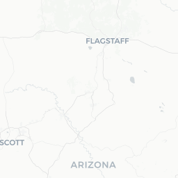
Peach Springs is a small community of roughly 1,100 people situated along Historic Route 66 in Mohave County, northwestern Arizona. It serves as the tribal capital of the Hualapai Nation, whose ancestral territory encompasses about one million acres along the south rim of the Grand Canyon.
The town sits at an elevation of approximately 4,800 feet on the Coconino Plateau, giving it a noticeably cooler climate than the desert valleys below. Despite its modest size, Peach Springs draws visitors from around the world because Diamond Creek Road — managed by the Hualapai Tribe — offers the only road access to the Colorado River within the Grand Canyon corridor anywhere along its length.
For travelers, the town functions primarily as a gateway and overnight base. Most services are limited, so arriving prepared is important. The surrounding landscape of high desert, pinyon-juniper woodland, and dramatic canyon terrain makes the area compelling for those willing to slow down and engage with both the natural environment and the living culture of the Hualapai people.
Before You Go
Permits and Tribal Land Access
Peach Springs and the surrounding area fall within the Hualapai Reservation. Access to Diamond Creek Road, the Colorado River beach, and whitewater rafting operations requires a permit or booking through the Hualapai Tribe's tourism arm, Hualapai River Runners. Verify current permit requirements and fees directly with the tribe before your visit, as policies can change.
Visas
Peach Springs is within the United States. For visa requirements based on your nationality, check TravelerPulse's Visas section and consult the U.S. Department of State or your nearest U.S. embassy or consulate.
What to Pack
- Water and snacks: grocery options in town are extremely limited
- High-clearance vehicle or AWD if you plan to drive Diamond Creek Road, which is unpaved and crosses the creek multiple times
- Sun protection, layers for cooler evenings at elevation, and sturdy footwear
- Cash: card payment acceptance is not guaranteed at all local businesses
Connectivity
Cell service in Peach Springs and along Diamond Creek Road is unreliable. Download offline maps before arrival and do not rely on real-time navigation once off Route 66.
Getting There
Peach Springs sits on Historic Route 66, approximately 54 miles east of Kingman, Arizona, and about 195 miles northwest of Flagstaff. There is no commercial air service or passenger rail to Peach Springs itself.
By Car: Driving is the practical way to reach the town. From Kingman, head east on Andy Devine Avenue, which becomes Route 66. From Flagstaff, take I-40 west to Seligman, then follow Route 66 northwest. Roads are generally well-maintained until you leave the highway.
Nearest Major Airports: Kingman Airport (IGM) handles limited charter and general aviation. For commercial flights, McCarran/Harry Reid International Airport in Las Vegas (LAS) and Phoenix Sky Harbor (PHX) are the realistic options, both roughly 2.5–3 hours by road. Flagstaff Pulliam Airport (FLG) offers some regional service and is about 2 hours east.
Bus/Shuttle: No scheduled intercity bus service stops in Peach Springs. Verify locally whether any regional shuttle operators serve the area.
Getting Around
There is no public transit within Peach Springs. A personal vehicle is essential for getting around and for reaching the area's main attractions.
Diamond Creek Road, the 21-mile unpaved track leading from town down to the Colorado River, crosses Diamond Creek numerous times. Road conditions vary significantly with rainfall and season — flash flooding can make the road impassable without warning. Always check current road conditions with the Hualapai Tribe's tourism office before attempting the drive, and a high-clearance vehicle is strongly recommended.
For river trips and guided excursions, Hualapai River Runners typically provides transport to and from the river as part of their packages. Confirm logistics when booking.
Where to Stay
Accommodation options in Peach Springs are very limited. The primary lodging in town is the Hualapai Lodge, operated by the Hualapai Tribe and serving as the main hub for visitors. It offers rooms, a restaurant, and serves as the check-in point for many tribal tourism activities. Verify current availability and rates directly with the lodge or the Hualapai Tourism office, as capacity is small and demand can be high during peak season.
Camping at the Colorado River beach at Diamond Creek is available with a tribal permit — this is a memorable option for those doing river trips or simply wanting to overnight at the canyon bottom. Facilities are primitive; come self-sufficient.
If you need more accommodation options, the city of Kingman (about 54 miles west) offers a wider range of hotels and motels at varying price points.
Things to See & Do
Diamond Creek Road and the Colorado River
The signature experience in the area is driving or being driven down Diamond Creek Road to the Colorado River. This is the only road access to the river within the Grand Canyon, and the beach at the bottom is a legal put-in and take-out point for multi-day Grand Canyon river trips. The canyon scenery along the descent is dramatic even if you never reach the water.
Hualapai River Runners
The tribe operates single-day and multi-day whitewater rafting trips through the lower Grand Canyon. These trips are a rare opportunity to experience Grand Canyon rapids without a multi-year permit waitlist. Book well in advance, especially for summer departures. Confirm current scheduling and pricing with Hualapai Tourism.
Grand Canyon West (Skywalk)
Grand Canyon West, home to the famous glass-bottomed Skywalk, is located on Hualapai land roughly 70 miles northwest of Peach Springs (road distance). It is operated separately from Peach Springs tourism and requires its own admission package. Verify current access and pricing on the Grand Canyon West official site.
Historic Route 66
Peach Springs lies along one of the best-preserved stretches of the original Route 66 corridor. The drive east toward Seligman or west toward Kingman passes through classic high-desert scenery and occasional roadside remnants of mid-20th-century American travel culture.
Cultural Engagement
The Hualapai people have lived in this region for centuries. Visitors are encouraged to engage respectfully with tribal cultural offerings where available. Check with the Hualapai Tourism office for any guided cultural programs, which may vary seasonally.
Food & Drink
Dining options in Peach Springs are minimal. The restaurant at the Hualapai Lodge is the main sit-down option in town and serves as the practical choice for most visitors. Hours and menu offerings should be verified locally, as they can change.
There is a small convenience store in town, but travelers should not rely on it for full provisioning. If you plan to spend time on Diamond Creek Road, at the river, or on a multi-day trip, bring sufficient food and water from Kingman or Seligman before arriving.
Alcohol regulations on tribal land may differ from surrounding areas. Confirm current rules with local businesses or the tribe's tourism office.
Practical Information
Emergency Services
For emergencies, dial 911. The nearest hospital with full emergency services is in Kingman (Kingman Regional Medical Center). Given the remote nature of the area and unreliable cell service, travelers should be aware that emergency response times may be longer than in urban settings.
Money
ATM access is extremely limited in Peach Springs. Carry sufficient cash before arriving. Credit card acceptance is not guaranteed at all businesses.
Fuel
Fuel availability in Peach Springs should be verified before arrival. It is prudent to fill your tank in Kingman or another larger town before heading into the area, especially if you plan to drive Diamond Creek Road.
Time Zone Note
Arizona does not observe Daylight Saving Time, so the time offset from Eastern and Pacific time changes depending on the time of year. Peach Springs is on Hualapai Nation land, which follows the Arizona state standard (no DST) — distinct from the neighboring Navajo Nation, which does observe DST.
Safety
The primary safety considerations in and around Peach Springs are environmental rather than crime-related. Flash flooding is a serious and rapid hazard in the canyon country. Diamond Creek Road crosses a creek repeatedly, and rain — even from storms miles away — can cause sudden flooding. Never attempt the road if heavy rain is in the forecast, and always check conditions with the tribal tourism office.
Heat is a significant risk in summer. Temperatures at the Colorado River canyon bottom can exceed 110°F (43°C). Carry far more water than you think you need — a minimum of one gallon per person per day is a standard guideline in desert environments, more in extreme heat.
Cell phone coverage along Diamond Creek Road and at the river is essentially nonexistent. File a trip plan with someone reliable, and do not assume you can call for help if something goes wrong. A satellite communicator device is worth considering for backcountry travel here.
Local Culture & Etiquette
Peach Springs is the governmental and cultural heart of the Hualapai Nation. The Hualapai (pronounced roughly WALL-uh-pie, from their own name meaning 'people of the tall pines') have maintained a connection to this plateau and canyon country for generations, surviving a difficult colonial history including forced removal in the 19th century.
When visiting, treat the reservation as you would any community — not as a theme park. Ask before photographing people, respect any areas marked as restricted, and engage with tribal offerings in a spirit of genuine curiosity rather than extractive tourism. Purchasing goods or services from Hualapai-operated businesses directly supports the community.
The tribe manages its own tourism operations deliberately, choosing to control how visitors experience their land and culture. This is worth understanding and respecting as a visitor: the access you have to the Grand Canyon through Hualapai land is a privilege extended by the tribe, not a generic public recreation right.