
AirlinesAirports.com
Powered by Google TranslateTranslate
Travel planning byTravelerPulse.pro
São Gabriel da Cachoeira Airport Coastal & Island Airport illustrationCoastal & Island Airport
Airports
SJLmedium airport

São Gabriel da Cachoeira Airport

Explore São Gabriel da Cachoeira city guide Navigate to this airport
1
Routes out
1
Destinations
SBUA
ICAO
249 ft
Elevation
AirlinesAirports profile

Gateway to Brazil's remote upper Rio Negro region.

Location
São Gabriel da Cachoeira, Brazil
São Gabriel da Cachoeira Airport (IATA: SJL, ICAO: SBUA) serves the remote municipality of São Gabriel da Cachoeira in Amazonas state, Brazil. Located in one of the most isolated regions of the Amazon, the airport provides a critical air link for a city accessible primarily by air or lengthy river travel. The airport supports the local population, indigenous communities, military personnel, and occasional researchers visiting the surrounding biodiversity-rich rainforest. It handles limited scheduled regional traffic alongside cargo and charter operations. São Gabriel da Cachoeira is notable for being the municipality with the highest proportion of indigenous people in Brazil, and the airport serves as a vital lifeline connecting this community to broader Brazil.
Terminals
The airport has a small, single terminal building suited to low passenger volumes typical of remote Amazonian airports.
Getting to & from
Ground transport from the airport into the town of São Gabriel da Cachoeira is limited, with taxis and informal vehicles being the primary options.
Airlines here
Azul Brazilian Airlines has operated scheduled service to this airport, providing connections to Manaus and other regional points.
Notable facts
  • São Gabriel da Cachoeira is one of the most remote cities in Brazil, making the airport essential for connectivity.
  • The surrounding region contains a significant portion of Brazil's indigenous reserves and protected Amazon rainforest.
  • The city is home to one of the highest concentrations of indigenous people in Brazil.
  • River travel to Manaus can take several days, making air service the preferred option for most travelers.
  • The airport also serves Brazilian military operations in the sensitive border region near Venezuela and Colombia.
This profile is provided for general information only. Details may be inaccurate or outdated — always verify with the airport's official website before acting on them.
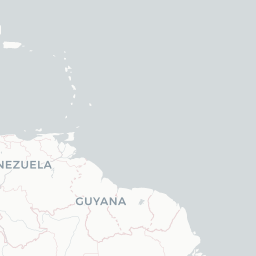
Route map (1 destinations)

Leaflet © OpenStreetMap © CARTO

Airlines serving this airport

Routes

SJL → TFFAD · AT4
Hotels near SJL

Pick what matters for your layover or early flight, then compare on your favorite booking site.

Compare stays for your dates

AirlinesAirports may receive compensation when you book or purchase through some of the links on this page, at no additional cost to you. Prices and availability are set by the booking provider and may change. We never share your private trip details with partners — only the destination, dates and party size you searched.

City & Place Guide

Gateway to the Amazon's most remote indigenous heartland.

São Gabriel da Cachoeira sits deep in the northwestern Amazon, where the Rio Negro curves through dense rainforest near Brazil's border with Colombia and Venezuela. It is one of Brazil's most indigenous cities, home to dozens of ethnic groups and the only municipality to officially recognize multiple indigenous languages alongside Portuguese.

The region is part of the vast Rio Negro Sustainable Development Reserve and sits near Pico da Neblina, Brazil's highest peak. Visitors come for raw Amazonian wilderness, river exploration, and genuine contact with living indigenous cultures largely untouched by mass tourism.

Traveling here requires planning and, for certain areas, official permits from FUNAI, Brazil's indigenous affairs agency. Infrastructure is minimal, which is precisely the appeal for adventurous travelers seeking an authentic, off-grid Amazonian experience.

  • Pico da Neblina — Brazil's highest peak, a challenging expedition through cloud forest and tepui landscape.
  • Rio Negro rapids and beaches — dramatic river scenery with white-sand beaches emerging in the dry season.
  • Mercado Municipal — lively local market showcasing regional produce, fish, and indigenous crafts.
  • Serra do Imeri — dramatic table-top mountains forming a striking backdrop to the surrounding rainforest.
  • Local indigenous communities — culturally rich villages offering insight into Baniwa, Tukano, and Yanomami traditions.
  • Cucuí border area — remote tri-border point where Brazil, Colombia, and Venezuela converge along the river.

Getting around: There are no roads connecting São Gabriel da Cachoeira to the rest of Brazil's highway network, so travel within the region relies almost entirely on boats along the Rio Negro and small charter flights. Within town, motorcycle taxis are the primary mode of transport, supplemented by a handful of local taxis and walking in the compact center.

Best time: Visit between June and November during the dry season when river levels drop to reveal beaches, trails are more accessible, and the weather is drier for trekking expeditions.

Local food: Try fresh tucunaré and jaraqui fish grilled or stewed in regional broths, alongside traditional indigenous staples like beiju flatbread made from manioc and foraged forest fruits.

This guide is provided for general information only. Verify details locally before making travel decisions.

Passport, Visa & Immigration

Flying internationally via SJL? Check entry, transit and customs requirements for Brazil from official government sources.

Encyclopaedia

São Gabriel da Cachoeira Airport, also called Uaupés Airport, is the airport serving São Gabriel da Cachoeira, Brazil.

Read full article on Wikipedia

Latest news

No recent news found.