
AirlinesAirports.com
Travel planning byTravelerPulse.pro
Bella Coola Airport Mountain Airport illustrationMountain Airport
Airports
QBCmedium airport

Bella Coola Airport

Bella Coola, Canada
Explore Bella Coola city guide Navigate to this airport
2
Routes out
2
Destinations
CYBD
ICAO
117 ft
Elevation
AirlinesAirports profile

Remote gateway to British Columbia's Central Coast wilderness.

Location
Bella Coola, Canada
Bella Coola Airport (IATA: QBC, ICAO: CYBD) is a small regional airport serving Bella Coola, a remote community in the Central Coast region of British Columbia, Canada. The airport provides essential air access to a community largely isolated by rugged mountain terrain, with limited road connections. The airport is owned and operated by the Bella Coola Valley and serves both scheduled passenger services and general aviation. It plays a critical role in connecting residents to larger urban centres, particularly Vancouver, for medical, commercial, and personal travel. The surrounding area is known for spectacular natural scenery, including Tweedsmuir Provincial Park, grizzly bear viewing, and salmon fishing, making the airport an important entry point for eco-tourism and adventure travelers.
Terminals
The airport has a small, single terminal building typical of a remote regional facility, with minimal amenities.
Getting to & from
Ground transport options from the airport are limited, with private vehicles and local taxi services being the primary means of reaching the community.
Airlines here
Pacific Coastal Airlines has historically provided scheduled service connecting Bella Coola to Vancouver International Airport.
Notable facts
  • ›Bella Coola is located at the head of a fjord in the Coast Mountains of British Columbia.
  • ›The airport elevation is approximately 117 feet (36 metres) above sea level.
  • ›Access by road requires traveling the notorious 'Freedom Road' (Highway 20) through the Chilcotin Plateau.
  • ›The airport serves as a lifeline link for medical evacuations and essential supplies.
  • ›Tweedsmuir Provincial Park, one of BC's largest parks, is accessible from the Bella Coola Valley.
This profile is provided for general information only. Details may be inaccurate or outdated — always verify with the airport's official website before acting on them.

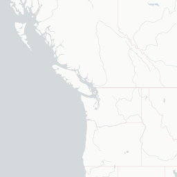
Route map (2 destinations)

Leaflet © OpenStreetMap © CARTO

Airlines serving this airport

Routes

QBC → YVR8P · BE1
QBC → YAA8P · BE1

Aircraft operating here

Hotels near QBC

Pick what matters for your layover or early flight, then compare on your favorite booking site.

Compare stays for your dates

AirlinesAirports may receive compensation when you book or purchase through some of the links on this page, at no additional cost to you. Prices and availability are set by the booking provider and may change. We never share your private trip details with partners — only the destination, dates and party size you searched.

City & Place Guide

Remote wilderness gateway nestled between mountains and the Pacific

Bella Coola is a small, remote community in the Central Coast region of British Columbia, situated at the head of a fjord surrounded by towering mountains and old-growth rainforest. It sits on the traditional territory of the Nuxalk Nation, whose rich culture and history permeate the valley.

The town serves as a launching point for world-class outdoor adventures, including grizzly bear viewing, sport fishing, kayaking, and hiking in Tweedsmuir Provincial Park. Despite its isolation, Bella Coola draws dedicated travelers seeking raw, unspoiled wilderness far from tourist crowds.

Access to Bella Coola is either by small aircraft, BC Ferries Discovery Coast Passage, or the famously steep and winding Highway 20, known as 'The Hill,' which connects to Williams Lake roughly 450 kilometers to the east.

  • •Tweedsmuir Provincial Park — British Columbia's largest park with glaciers, trails, and wildlife
  • •Atnarko River — premier salmon and steelhead fly-fishing destination
  • •Hagensborg — historic Norwegian settlement with heritage buildings and cultural charm
  • •Nuxalk Nation cultural sites — totem poles and traditional art showcasing Indigenous heritage
  • •Bella Coola Valley trails — scenic hikes through old-growth forest and alpine meadows
  • •Saloompt River — excellent grizzly bear viewing especially during salmon season

Getting around: Bella Coola has no public transit system, so a rental car or personal vehicle is essentially required to explore the valley. Taxis are extremely limited and rideshare services like Uber do not operate here. Some lodges offer shuttle services for guests, and guided tour operators can provide transportation as part of excursion packages.

Best time: Late summer to early fall, roughly July through September, offers the best weather, peak salmon runs, and prime grizzly bear viewing opportunities.

Local food: Try fresh wild Pacific salmon prepared simply at local lodges, alongside foraged mushrooms and berries that reflect the region's abundant wilderness pantry.

This guide is provided for general information only. Verify details locally before making travel decisions.

Passport, Visa & Immigration

Flying internationally via QBC? Check entry, transit and customs requirements for Canada from official government sources.

Bella Coola Airport
Encyclopaedia

Bella Coola Airport is located 6 nautical miles northeast of Bella Coola, British Columbia, Canada.

Read full article on Wikipedia

Entity data from open aviation datasets (OurAirports, OpenFlights) with AI-assisted editorial clearly marked. Always confirm time-sensitive details with the official airport website. Sources & verification