AirlinesAirports.com
Powered by Google TranslateTranslate
Travel planning byTravelerPulse.pro
Montrose Regional Airport Regional Airport illustrationRegional Airport
Airports
MTJmedium airport

Montrose Regional Airport

Montrose, United States
Explore Montrose city guide Navigate to this airport
1
Routes out
1
Destinations
KMTJ
ICAO
5759 ft
Elevation
AirlinesAirports profile

Colorado's gateway to the San Juan Mountains and ski country.

Opened
1938
Location
Montrose, United States
Montrose Regional Airport (MTJ/KMTJ) is a public airport serving Montrose, Colorado, and the surrounding Western Slope region. It sits at an elevation of approximately 5,759 feet above sea level, making it one of the higher-altitude commercial airports in the United States. The airport primarily serves leisure travelers heading to nearby ski resorts, including Telluride Ski Resort and Crested Butte, as well as visitors to Black Canyon of the Gunnison National Park. Seasonal service tends to expand significantly during winter months to meet ski tourism demand. Montrose Regional is owned and operated by the City of Montrose and has undergone infrastructure improvements in recent years to accommodate growing passenger traffic and expanded airline service.
Terminals
The airport features a single passenger terminal with a modest number of gates serving commercial and general aviation operations.
Getting to & from
Ground transportation options include rental car agencies located at the terminal, taxis, and shuttle services connecting to Montrose and surrounding resort communities.
Airlines here
Airlines serving MTJ include American Airlines, United Airlines, Delta Air Lines, and Southwest Airlines, with seasonal additions from carriers such as Alaska Airlines.
Notable facts
  • Sits at an elevation of approximately 5,759 feet MSL, one of the higher commercial airports in the U.S.
  • Serves as a key gateway to Telluride Ski Resort, located about 65 miles to the south.
  • Passenger traffic increases substantially during winter ski season.
  • Black Canyon of the Gunnison National Park is accessible within roughly 15 miles of the airport.
  • The airport has received FAA grants to expand and modernize facilities to handle increased traffic.
This profile is provided for general information only. Details may be inaccurate or outdated — always verify with the airport's official website before acting on them.
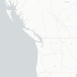

Route map (1 destinations)

Leaflet © OpenStreetMap © CARTO

Airlines serving this airport

Routes

MTJ → DENUA · DH4
Hotels near MTJ

Pick what matters for your layover or early flight, then compare on your favorite booking site.

Compare stays for your dates

AirlinesAirports may receive compensation when you book or purchase through some of the links on this page, at no additional cost to you. Prices and availability are set by the booking provider and may change. We never share your private trip details with partners — only the destination, dates and party size you searched.

City & Place Guide

Gateway to the San Juan Mountains and Colorado's outdoor adventure hub.

Montrose is a mid-sized city in western Colorado, sitting at roughly 5,800 feet elevation on the Uncompahgre Plateau. It serves as a practical base for exploring the dramatic canyons, mountains, and wilderness areas that surround it, including the nearby Black Canyon of the Gunnison National Park.

The city has a relaxed, working-Western character with a growing arts scene, farm-to-table dining, and a friendly local culture. Outdoor enthusiasts flock here for world-class hiking, mountain biking, skiing at nearby Telluride, and exceptional trout fishing on the Gunnison River.

Montrose Regional Airport offers direct flights from several major U.S. cities, making it surprisingly accessible for a mountain gateway of its size. The downtown area is compact and walkable, with independent shops, breweries, and galleries worth exploring between adventures.

  • Black Canyon of the Gunnison National Park — stunning sheer-walled gorge just 15 miles east.
  • Ute Indian Museum — award-winning museum honoring the Indigenous heritage of the region.
  • Curecanti National Recreation Area — dramatic reservoirs and canyons ideal for boating and birding.
  • Ridgway State Park — scenic reservoir with camping, swimming, and mountain views.
  • Downtown Montrose Arts District — murals, galleries, and local shops in a compact walkable core.
  • Owl Creek Pass — breathtaking scenic drive through aspen groves with views of the Cimarron Range.

Getting around: Montrose has no local rail or robust public transit system, so a rental car is strongly recommended for visitors. Taxis are limited; rideshare services like Uber and Lyft operate in the area but availability can be inconsistent. The airport has several major car rental agencies on-site, making it easy to pick up a vehicle upon arrival.

Best time: Late spring through early fall (May–October) offers the best weather for outdoor activities, with July and August being peak season for hiking and festivals.

Local food: Try locally raised Colorado lamb, fresh Gunnison River trout, green chile dishes, and craft beers from Montrose Brewing Company reflecting the agricultural richness of the region.

This guide is provided for general information only. Verify details locally before making travel decisions.

Passport, Visa & Immigration

Flying internationally via MTJ? Check entry, transit and customs requirements for United States from official government sources.

Montrose Regional Airport
Encyclopaedia

Montrose Regional Airport is a non-towered public airport on the northwest side of Montrose, in zip code 81401 in southwestern Colorado. Its two runways are at elevation 5,759 feet. MTJ covers 966 acres of land.

Read full article on Wikipedia