Translate


Gateway to Alaska's Arctic North Slope community.
Location
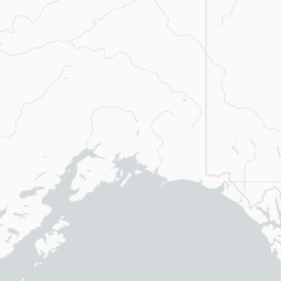
Utqiaġvik, United States
Wiley Post–Will Rogers Memorial Airport serves Utqiagvik (formerly Barrow), Alaska, the northernmost city in the United States. The airport is a critical lifeline for the remote community, as there are no roads connecting Utqiagvik to the rest of Alaska's highway system, making air travel the primary means of transportation for passengers and cargo.
The airport is named in honor of aviator Wiley Post and humorist Will Rogers, who died in a plane crash near Point Barrow in August 1935. The facility is owned and operated by the North Slope Borough and handles scheduled commercial service as well as cargo and charter operations year-round despite the extreme Arctic climate.
Flights at BRW operate in some of the harshest conditions in North America, including prolonged periods of polar night in winter and the midnight sun in summer. The airport is essential for supplying the community with food, medical supplies, and other goods.
Terminals
The airport has a single terminal building serving all commercial and cargo operations.
Getting to & from
Ground transport from the airport to Utqiagvik is limited to taxis and private vehicles, as no public bus system operates the route.
Airlines here
Alaska Airlines provides scheduled jet service to Utqiagvik, while Ravn Alaska (and successor carriers) have historically provided regional turboprop connections.
Notable facts
- ›Named after aviator Wiley Post and Will Rogers, who died near Barrow in a 1935 plane crash.
- ›Serves the northernmost city in the United States, located above the Arctic Circle.
- ›Air transport is the sole practical means of reaching Utqiagvik, as no road links exist.
- ›The airport operates year-round despite extreme Arctic weather, including temperatures well below -40°F.
- ›Owned and operated by the North Slope Borough, the local government authority.
This profile is provided for general information only. Details may be inaccurate or outdated — always verify with the airport's official website before acting on them.