


AirlinesAirports.com
Travel planning byTravelerPulse.pro
Chacalluta International Airport Mountain Airport illustrationMountain Airport
Airports
ARImedium airport

Chacalluta International Airport

Arica, Chile
Explore Arica city guide Navigate to this airport
5
Routes out
4
Destinations
SCAR
ICAO
167 ft
Elevation
AirlinesAirports profile

Chile's northernmost international gateway near the Peruvian border.

Opened
1965
Location
Arica, Chile
Chacalluta International Airport (IATA: ARI, ICAO: SCAR) serves Arica, a city in the Arica y Parinacota Region of far northern Chile, just kilometers from the Peruvian border. The airport handles domestic routes within Chile as well as limited international connections, primarily to Peru and Bolivia. The airport is named after the Chacalluta valley where it is located, and serves as an important transport hub for a region that is geographically isolated from the rest of Chile. Arica's proximity to Peru and Bolivia makes the airport strategically significant for cross-border trade and tourism. Passenger volumes are relatively modest compared to major Chilean airports, but the facility plays a key role in connecting the far north of Chile to Santiago and neighboring countries.
Terminals
The airport operates a single terminal building handling both domestic and international passengers.
Getting to & from
Taxis and shared transfer services are the primary ground transportation options connecting the airport to downtown Arica, approximately 15 kilometers away.
Airlines here
LATAM Airlines and Sky Airline are the primary carriers serving Chacalluta, operating routes to Santiago and other Chilean destinations.
Notable facts
  • ›Located approximately 18 km north of Arica city center, close to the Chilean-Peruvian border.
  • ›One of the northernmost airports in Chile.
  • ›Serves as a gateway for travelers crossing between Chile, Peru, and Bolivia in the Atacama region.
  • ›The surrounding Chacalluta wetlands near the airport are a protected ecological area and bird sanctuary.
  • ›The airport's elevation and desert climate result in relatively stable flying conditions year-round.
This profile is provided for general information only. Details may be inaccurate or outdated — always verify with the airport's official website before acting on them.

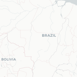
Route map (4 destinations)

Leaflet © OpenStreetMap © CARTO

Airlines serving this airport

Routes

ARI → LPBH2 · 320
ARI → ANFH2 · 319 320
ARI → IQQH2 · 319 320
ARI → IQQLA · 320
ARI → SCLLA · 320
Hotels near ARI

Pick what matters for your layover or early flight, then compare on your favorite booking site.

Compare stays for your dates

AirlinesAirports may receive compensation when you book or purchase through some of the links on this page, at no additional cost to you. Prices and availability are set by the booking provider and may change. We never share your private trip details with partners — only the destination, dates and party size you searched.

City & Place Guide

Chile's sunniest city where desert meets Pacific coast

Arica sits at Chile's far northern tip, just kilometers from the Peruvian border, earning the nickname 'City of the Eternal Spring' for its year-round mild, sunny climate. The city blends indigenous Aymara culture with a relaxed coastal vibe, offering beaches, ancient history, and dramatic desert landscapes all within easy reach.

As a major border city and free-trade zone, Arica is lively and affordable. It serves as a practical gateway to the altiplano, the Atacama Desert, and Lake Chungara, one of the world's highest lakes. The city's colonial heritage, visible in landmarks designed by Gustave Eiffel, adds unexpected architectural character to its sunny streets.

  • •El Morro de Arica — iconic clifftop fortress with panoramic Pacific views and a key battle memorial
  • •Catedral de San Marcos — iron church prefabricated by Gustave Eiffel, a rare architectural gem
  • •Museo de Sitio Colón 10 — displays remarkably preserved Chinchorro mummies, the world's oldest
  • •Playa El Laucho — calm, family-friendly beach ideal for swimming close to the city center
  • •Parque Nacional Lauca — stunning altiplano park with flamingos, vicuñas, and Lake Chungara
  • •Mercado Central — bustling market showcasing fresh seafood, local produce, and Aymara crafts

Getting around: Arica is compact and walkable in the center, with shared taxis called colectivos being the most popular and affordable local transport. City buses cover broader neighborhoods cheaply, while standard taxis are widely available for direct trips. Rideshare apps have limited presence, so colectivos and taxis are the practical go-to options. Rental cars are recommended for excursions to Lauca or the altiplano.

Best time: Arica is pleasant year-round, but May through October offers cooler, drier conditions ideal for sightseeing and highland day trips.

Local food: Try ceviche de mariscos, chupe de camarones (shrimp chowder), and picante de mariscos, all influenced by Peruvian flavors and best enjoyed at the Mercado Central.

This guide is provided for general information only. Verify details locally before making travel decisions.

Passport, Visa & Immigration

Flying internationally via ARI? Check entry, transit and customs requirements for Chile from official government sources.

Chacalluta International Airport
Encyclopaedia

Chacalluta International Airport is an airport serving the city of Arica, capital of the Arica Province in the northern Arica y Parinacota Region of Chile. It is 18.5 kilometres (11.5 mi) northwest of the city and 1 kilometre (0.62 mi) south of the border with Peru, adjacent to the village of Villa Frontera.

Read full article on Wikipedia

Entity data from open aviation datasets (OurAirports, OpenFlights) with AI-assisted editorial clearly marked. Always confirm time-sensitive details with the official airport website. Sources & verification